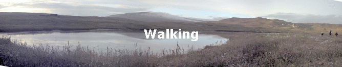
Walking
Local walks

We recommend the book “Walking the Coastline of Shetland no. 4 Northmavine” by Peter Guy. ISBN 0 952 0026 0 4. All the walks below are featured in the book and the distances and times listed are taken from the book.
Fog can occur in Shetland at any time of the year so if setting out on a long walk, or a walk near coastal cliffs please let someone know your plans. We will be happy to keep an eye out for you getting back

Maps

OS maps Landranger 1,2,3, and,4 are available for loan as is Pathfinder sheet HU27/37 covering Hillswick and Urafirth

Hillswick Ness

Walk B in Peter Guy's book. 5 Miles, 8Km. Estimated time 3 Hours.
This is a fairly easy walk but caution must be taken whilst walking near the edge of the cliffs.
Points of note are the views from the lighthouse and of the Gordi Stack and the Drongs.
The maps to use are OS Landranger Sheet 3 Shetland – North Mainland. Or OS Pathfinder Sheet HU 27/37 Hillswick.

Ronas Hil

Walk G in Peter Guy's book. 15 Miles, 20Km. Estimated time 7 Hours.
The maps to use are OS Landranger Sheets 1 and 3. Or Pathfinder Sheet HU28/38 Ronas Hill.
 

Fethaland

Walk I in Peter Guy's book. 6 Miles, 10Km. Estimated time 3 Hours.
This is a fairly easy walk to the very tip of mainland Shetland.
The maps to use are OS Landranger Sheets 1 and 2. Or Pathfinder Sheet HU39/49 Yell Sound (North)